 Atlas
Atlas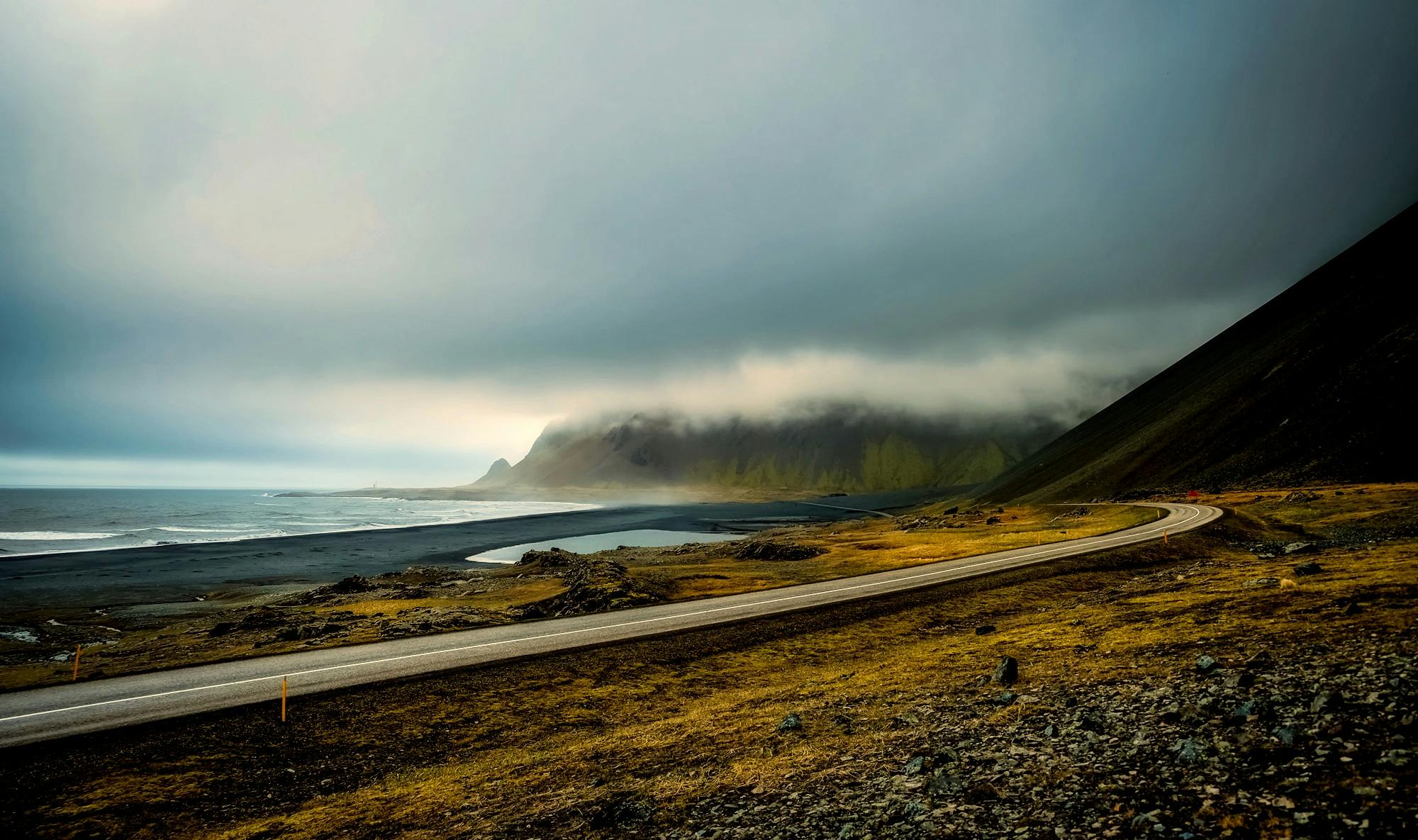
A country born of fire and ice
Iceland is one of the youngest and most geologically active lands on the planet. Located in the North Atlantic Ocean, precisely on the boundary between the North American and Eurasian plates, the island sits above a geothermal hotspot that formed it 16–18 million years ago and continues to shape it today.
The result is a landscape unlike any other: around 200 active volcanoes, geothermal springs everywhere, immense glaciers — including Vatnajökull, Europe’s largest ice cap — and a succession of black lava deserts, spectacular waterfalls and dark-sand beaches. Since 1500, roughly one-third of all the lava erupted on Earth has come from Icelandic volcanoes.
With an area of 103,000 km² and just 395,000 inhabitants — 35% concentrated in the capital, Reykjavík — Iceland offers a density of wilderness and open space that very few countries in the world can match.
The seven regions
South-West: Reykjavík and surrounding area
Reykjavík is the world’s northernmost capital and the natural gateway for almost every visitor. Compact, lively and culturally rich, it deserves at least two days: Hallgrímskirkja church, the Viking Saga Museum, the old harbour and the rúntur tradition — Icelandic weekend bar-hopping — are enough to fill your stay on their own. A short distance away lies the Reykjanes Peninsula, an area of intense recent volcanic activity, with lunar landscapes and the geothermal pools of the Blue Lagoon.
The Golden Circle
- Þingvellir: a UNESCO World Heritage Site, where you can physically see the separation between the two tectonic plates. It was home to the Alþing, the first democratic parliament in history (AD 930).
- Geysir: the geothermal area that gave its name to geysers around the world. Strokkur erupts every 5–10 minutes, shooting boiling water up to 40 metres into the air.
- Gullfoss: a double drop into the Hvítá river canyon, with overwhelming force — especially in spring when fed by meltwater.
South Coast
- Seljalandsfoss: the only Icelandic waterfall you can walk behind. Bring a waterproof jacket.
- Skógafoss: a 60-metre vertical wall of water, often wrapped in rainbows.
- Reynisfjara: the black basalt beach with rock columns and unpredictable waves. Never turn your back on the ocean.
- Sólheimajökull: a glacier tongue reachable on foot in ten minutes, ideal for glacier hikes.
South-East: the realm of glaciers
- Skaftafell: a network of trails among glacier tongues, basalt canyons (Svartifoss) and birch forests.
- Jökulsárlón: the glacial lagoon where icebergs break away from the glacier and drift towards the sea. Sunset here is one of the most powerful visual experiences on the island.
- Diamond Beach: fragments of iceberg wash up on the black sand like crystal sculptures lit by the sun.
Eastfjords
The least visited region along the main route — and perhaps the most authentic. Small fishing villages with colourful wooden houses, cliffs home to puffin colonies and wild reindeer (the only place on the entire island where they can be spotted). Seyðisfjörður, reached via a spectacular mountain pass, is a gem of Norwegian architecture and independent artistic culture.
North: Akureyri, Mývatn and Húsavík
- Akureyri: the capital of the north, with a surprisingly mild microclimate and a lively cultural scene.
- Goðafoss: the waterfall of the gods, where in AD 1000 the parliament decreed the adoption of Christianity.
- Lake Mývatn: a unique ecosystem with pseudocraters, sulphur springs, lava fields (Dimmuborgir) and thousands of ducks.
- Dettifoss: Europe’s most powerful waterfall by water volume. No railings — just nature’s raw force.
- Húsavík: the world capital of whale watching, with sightings virtually guaranteed between June and August.
Westfjords
The Vestfjörðir are Iceland’s most remote and least accessible region. Látrabjarg cliff, Europe’s westernmost, is home to millions of seabirds. Dynjandi is a fan-shaped waterfall cascading freely for 100 metres. The gravel roads require a 4×4 and plenty of time: this is not a place for rushed itineraries.
When to go: the four seasons
- Summer (June–August): midnight sun, all roads accessible, temperatures of 10–15°C. High season: book months in advance.
- Spring (April–May): fewer crowds, prices 20–30% lower, northern lights still possible in April, rivers swollen with meltwater.
- Autumn (September–October): the northern lights return, the tundra colours are extraordinary and tourism has eased. Often the best time for balance.
- Winter (November–March): few daylight hours and some road closures, but the highest chance of northern lights and the country at its most authentic.
Getting around Iceland
The Ring Road (Route 1) is the backbone of an Icelandic road trip: 1,322 km circling the island and linking its main attractions. To travel it at a relaxed pace, allow 7 to 10 days. Do not drive more than 200–250 km per day: on Icelandic roads, that distance often takes up a full day.
- F-roads (Highlands): a 4×4 is mandatory, they are open only in summer, and some include river crossings.
- Dipped headlights must always be on, even during the day. Alcohol limit: zero.
- Sheep have absolute right of way on the roads.
- Check road.is every morning for road conditions, and vedur.is for the weather forecast.
Staying safe in nature
- Never turn your back on the ocean on black-sand beaches: sneaker waves strike without warning.
- Do not step on moss: it takes decades to grow and is one of the island’s most fragile ecosystems.
- Respect closure signs, which are often related to unstable ground or volcanic hazards.
- Emergency number: 112 — it covers all emergencies, including mountain rescue.
- Register your itinerary on safetravel.is before any hike in remote areas.
Culture and history: the Viking legacy
Iceland was settled between AD 874 and 930 by Norse and Celtic settlers. In 930, the Alþing was founded at Þingvellir: the first democratic parliament in history. The Icelandic language has remained remarkably close to Old Norse — a modern Icelander can read medieval sagas without difficulty. The Icelandic Sagas, written between the 12th and 14th centuries, are among the masterpieces of world literature. Leifur Eiríksson reached North America around 500 years before Columbus. Iceland holds the global record for books published and read per capita.
Icelandic cuisine: from sea to table
- Skyr: a thick, protein-rich dairy product and an essential breakfast staple. Similar to Greek yoghurt, but lower in fat.
- Plokkfiskur: a creamy fish stew made with cod or haddock, potatoes and onion. Icelandic comfort food at its finest.
- Pylsur: the Icelandic hot dog — with raw onion, fried onion, sweet ketchup and sweet mustard. Iconic.
- Icelandic lamb: raised free-range in the Highlands, without artificial feed. It tastes completely different from intensively farmed meat.
- Geothermal pools: they are not a tourist attraction — they are where Icelanders meet every day. Go.
What to wear: the layering rule
- 01Base: breathable technical fabric
- 02Mid-layer: thermal fleece
- 03Outer layer: waterproof, windproof jacket — essential in every season
Icelandic wind turns 10°C into something far less welcoming. Always carry an extra jacket in your backpack, even on summer days that seem settled.
Plan your trip with Iceland Atlas
- Discover AttractionsExplore attractions, towns and hikes with filters by region, season and category
- Create ItineraryGenerate a tailored plan based on your available days, travel pace and preferences
- MapCheck distances, stop clusters and the logistical flow of your route
- Where to StayAccommodation selected by area, travel style and pace
- Where to EatRestaurants and stops along the route, from Reykjavík to the Fjords
- Northern Lights LiveNight forecasts, cloud cover and the best areas for chasing the northern lights
- Road StatusReal-time road conditions, severity and webcams — check every morning
- Volcanoes LiveStatus of active volcanic systems and real-time updates


